Utm
Advertisement
GeographicLib v.1.22
Geographic conversion made easy. GeographicLib is a small set of C++ classes for performing conversions between geographic, UTM, UPS, MGRS, geocentric, and local cartesian coordinates, for geoid height calculations, and for solving geodesic problems.
Advertisement
UserGate Proxy & Firewall v.6.4
UTM (Unified Threat Management) class solution for sharing and monitoring employees' access to the local and Internet resources, for filtering FTP and HTTP traffic, as well as for administrating the network in your Company.
Geodaten International Admin
Geo data international world-wide with towns, town quarters and postal codes. Georeferences as UTM- and geographic coordinates (WGS84) and elevations. Suitable for branch searches, periphery searches and distance computations. Australia, Austria,
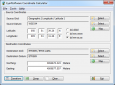
Eye4Software Coordinate Calculator v.3.2.12.208
Eye4Software Coordinate Calculator is a very easy to use tool to perform gps coordinate conversions. Supported projections: Transverse Mercator, Lambert Conformal Conic, UTM, Gauss Kruger, Stereographic, Albers Equal Area, Oblique Mercator and more.
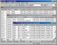
Geo Data International Streets
For many countries street coordinates are present with coverage degrees of 100 percent. The geo data offered here are in high-precision quality and are present in several coordinate and reference systems (Geographic, UTM / WGS84, ETRS89). Street
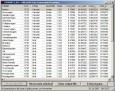
Geo Data International Houses
For many countries house coordinates are present with coverage degrees of 100 percent. The geo data offered here are in high-precision quality and are present in several coordinate and reference systems (Geographic, UTM / WGS84, ETRS89). House Coordinates
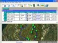
EdiTrail v.1.0
Create/Edit/Display/Management/Import/Export Trails/Routes in a simple and flexible environment divided in a data table for the management of trails and a map resulting from numerous providers, (Bing, Arcgis, Ovi, Yahoo, etc).
GPS Sway v.1.0
GPS Sway is a simple coordinate conversion program. It handles all forms of latitude and longitude (degrees, degrees minutes, degrees minutes seconds) as well as UTM coordinates and will convert from any form to another.
GeoMag v.3.0.0.2
The Geographic Magnetic Calculator is a tool to help you determine UTM Coordinates and the Magnetic Declination that correspond to a longitude/latitude location.
DatumPro v.3.4.0.2
DatumPro is the most comprehensive and accurate co-ordinate conversion package available, handling thousands of coordinate systems, including Gauss Kruger, UTM, and Lambert Conic grids With over 600 datum conversions and over 450 Grid Projections, an
Geo Data German Admin (English) v.10 2
Geodata of the Federal Republic Germany with municipalities, postal codes, telefone preselections. Suitable for branch searches, periphery searches and distance computations. Georeferences as Gauss Krueger, UTM and geographic coordinates. ORTREF: